View in 360! • Flight1549 360VR Immersive Reconstruc...
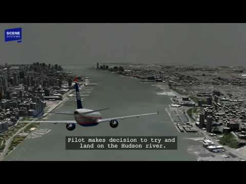
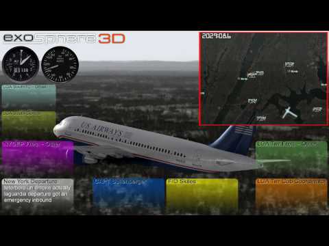
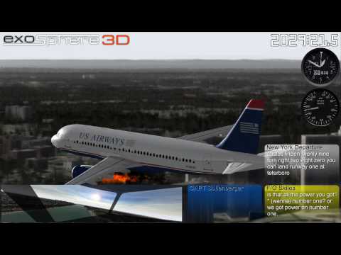
Full info:: http://www.exosphere3d.com/pubwww/pag... This animation is based on all currently available data concerning the US Airways Flight 1549 crash landing on the Hudson River (Cactus 1549). Satellite imagery, elevation models and robust GIS mapping methods are utilized to create a vegetation model, terrain model and ground clutter (3D buildings). Of all available audio tracks, only two are used, La Guardia Tower and New York TRACON Departure controller position. Radar data as well as the onboard Flight Data Recorder are utilized in constructing the flightpath of the aircraft.
The other version of this video: • Flight 1549 Alternate Audio, Multi-Pe...
The birds showing up on radar: • Detail View: Birds on Radar intersect...
a.k.a. Brace for Impact, Miracle on the Hudson